
 |
| The well-built wall of the circular structure |
Well! That's us finished up at Kay Craig after the smoothest hillfort backfill in SERF Project history. Done by 2pm and down to the Kirkstyle beer garden for a couple of pints before the end of dig BBQ.
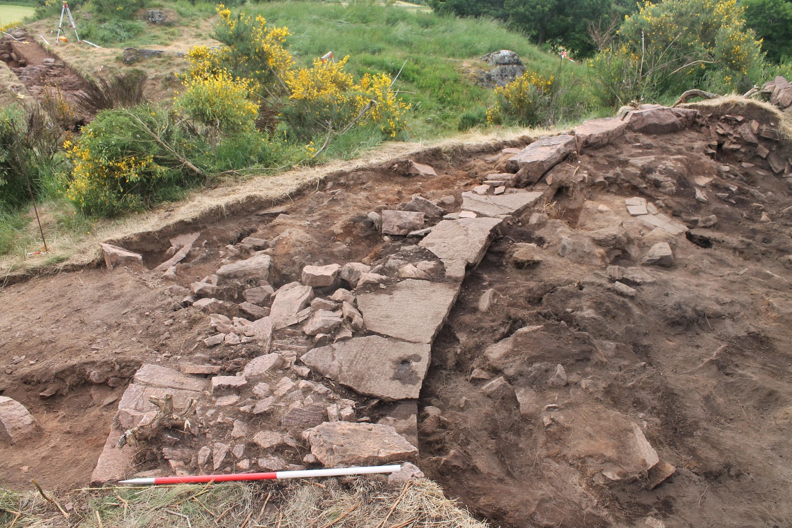
In the final week we continued to explore the circular structure at the top of the hill. Our provisional interpretation is that this is a site that has seen several phases of use.
One of the first phases is evident from a large ashy and charcoal rich layer across the top of the bedrock - possibly material from a burning event that has later been spread across the site to level out the uneven bedrock (unfortunately no finds from this layer so we will have to wait and see what the carbon dates say).
On top of this layer the circular structure with concentric boundary wall reminiscent of the broch at Castle Craig has been built. The structure wall is much smaller than a typical broch wall at 1.2m wide so we think this is probably a 'dun' site or smaller enclosed outpost, perhaps contemporary with the broch, although again we have to wait for carbon dates to be sure.
Later some of this structure wall has been disturbed by a combination of rabbit burrows, vegetation roots and probably some robbing of stone.
Some repairs have been done as the site was reused - this time with more rough angular stone blocks making up part of the wall while reusing the base course of the earlier structure. There was also a possible turf component to the structure and a small secondary hearth in a disturbed occupation layer. This hearth was up against one side of the reused structure and had enough slag nearby to suggest it was a secondary hearth for metal working. Several whetstones and the crucible plus a LOT of ash were near this spot as well.
This structure was then knocked down or fell down creating a layer of tumbled stone which was where most of the possible medieval finds came from.
 |
| Rock-cut ditch packed with stones |
Meanwhile the ditch and bank were excavated down to bedrock. The ditch looks like it has been deliberately filled in with a lot of flat angular stones to level the uneven bedrock surface and also to provide a more usable surface, perhaps for keeping livestock on or creating more space for other activity on the site.
The bank is presumably contemporary with the ditch as it follows the line of the ditch and a large quantity of the angular stone in it it has likely come directly from the quarried out ditch. No more finds in the ditch since the possible Iron age and possible medieval pottery so we will be waiting on yet more carbon dates to compare the date of this part of the site with the structures on the hill and the other sites in the area.
So as of yet there is all to play for but regardless of what period the activity on this site spans it is a really interesting addition to our project data.
A big thanks to everyone who helped out on the site, particularly our regulars; Veronica, Neil, Andrew, Bec, Jennifer, Alex and Lorraine. Special thanks to our superb supervisor Yvonne who kept it all running smoothly. And thanks to the locals who came to visit, the landowners who made us welcome and Mrs Kinnard for pointing us at the site in the first place.
Onwards and upwards to the next hillfort!
Cheers,
Cathy and Tessa
No comments:
Post a Comment
Your comment will appear on the blog shortly, thanks for following us! :)